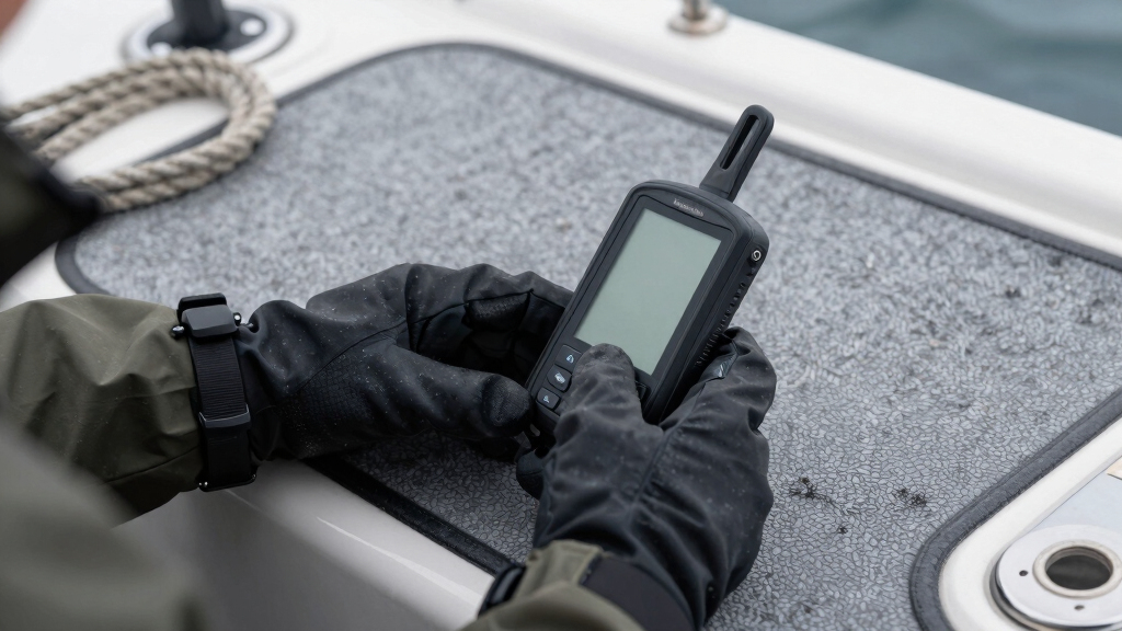
If you’re searching for the best handheld marine GPS units, you’re likely balancing rugged durability, accurate coastal charts, and long battery life. The Garmin GPSMAP 79sc stands out as a top choice for its preloaded BlueChart g3 coastal charts and water-floating design. The Garmin eTrex® SE offers excellent multi-GNSS support and sunlight-readable screens, making it versatile for various conditions. However, these options come with tradeoffs, like higher cost or complexity for advanced features. Keep reading for a detailed comparison to find the best fit for your needs.
Key Takeaways
- Top picks excel in durability and water resistance, critical for marine environments.
- Preloaded coastal charts significantly reduce setup time and improve navigation accuracy.
- Battery life varies greatly; models with longer runtime suit extended trips better.
- Additional features like satellite communication and floating designs cater to specific use cases.
- Pricing reflects feature set and build quality, so consider your budget against desired capabilities.


More Details on Our Top Picks
Garmin eTrex® SE GPS Handheld Navigator, Extra Battery Life, Wireless Connectivity, Multi-GNSS Support, Sunlight Readable Screen
This model stands out for its exceptional battery life—up to 1,800 hours in expedition mode—making it ideal for long trips where power sources are scarce. Its support for multiple satellite systems (GPS, GLONASS, Galileo, BeiDou, QZSS) ensures reliable tracking in challenging environments, outperforming simpler GPS units. The 2.2″ sunlight-readable display provides clear visibility in bright conditions, and wireless pairing with the Garmin Explore app allows for seamless updates and trip planning. The water-resistant IPX7 rating adds durability, but the reliance on AA batteries can be a drawback for those seeking rechargeable convenience. Compared to the Garmin GPSMAP 79sc, its longer battery life and multi-GNSS support make it more adaptable for extended outdoor use. This pick makes the most sense for adventurers who need dependable, versatile navigation without sacrificing battery endurance, though it may be less suited for those preferring built-in rechargeable batteries.
Pros:- Extra-long battery life (up to 1,800 hours in expedition mode)
- Supports multiple satellite systems for reliable positioning
- Sunlight-readable, high-resolution display
Cons:- Uses AA batteries which require carrying spare batteries
- Interface can be less intuitive for beginners
- No built-in maps—requires paired app for trip planning
Best for: Backcountry hikers and multi-day explorers who prioritize battery longevity and multi-system tracking capabilities.
Not ideal for: Casual boaters or anglers who prefer a water-resistant unit with integrated rechargeable batteries and preloaded marine charts.
- Display Size:2.2 inches
- Battery Life:up to 168 hours in standard mode, 1,800 hours in expedition mode
- GNSS Support:GPS, GLONASS, Galileo, BeiDou, QZSS
- Water Resistance:IPX7
- Connectivity:Wireless, Garmin Explore app
- Supported Maps:Basic, requires app
Bottom line: This is a strong choice for serious outdoor enthusiasts needing extended battery life and multi-GNSS support, though less ideal for casual or marine-focused users.
Garmin GPSMAP 79sc, Marine GPS Handheld Preloaded with BlueChart g3 Coastal Charts, Rugged Design and Floats in Water
Compared with the Garmin eTrex SE, the GPSMAP 79sc offers preloaded BlueChart g3 coastal charts, making it ideal for boaters needing detailed marine navigation. Its rugged, floating design is perfect for wet environments, rated water-resistant at IPX6, and it supports multiple satellite systems, ensuring accurate tracking at sea. The 6-inch high-resolution color display is larger and easier to read than smaller handhelds, and its 20-hour battery life suits day trips well. However, its bulkier size and weight may be less appealing for lightweight backpackers or hikers. While the eTrex SE excels in battery longevity and multi-GNSS in remote terrain, the GPSMAP 79sc’s strength lies in its marine-specific features and floating capability. This makes it the best choice for boaters and coastal adventurers who need reliable marine charts and durability, though less suitable for ultra-light hiking.
Pros:- Preloaded with detailed BlueChart g3 coastal charts
- Floating and water-resistant (IPX6)
- Large, high-res color display for easy navigation
Cons:- Bulkier and heavier than smaller handhelds
- Limited map customization options
- Less suited for extended backcountry use
Best for: Anglers and boaters seeking a durable, floating device with preloaded marine charts and reliable satellite tracking.
Not ideal for: Hikers or backpackers who prefer compact, lightweight units without marine-specific features.
- Display Size:6 inches
- Battery Life:up to 20 hours
- Water Resistance:IPX6
- Supports:GPS, GLONASS, BeiDou, Galileo, QZSS
- Chart Preloaded:BlueChart g3 Coastal
- Dimensions:not specified
Bottom line: Ideal for marine use and coastal adventures requiring durable, preloaded charts, though less suited for lightweight hiking or multi-day backpacking.
Garmin 010-02256-00 eTrex 22x, Rugged Handheld GPS Navigator, Black/Navy
This pick is ideal for hikers and outdoor enthusiasts seeking a reliable, straightforward device. Its 2.2″ sunlight-readable color display offers clear visibility, and the rugged construction provides durability in harsh conditions. Supporting both GPS and GLONASS satellite systems, it outperforms basic GPS units in challenging terrains. With 8 GB of internal memory and a microSD slot, it allows for custom map downloads, making it more versatile than simpler models like the NiesahYan A6. Battery life is impressive at up to 25 hours, suitable for day-long excursions, but it lacks a touchscreen, which can make navigation less intuitive for some. Compared to the Garmin eTrex SE, its rugged build and additional map capabilities make it a better fit for serious hikers, although it doesn’t include preloaded maps by default. This is a cost-effective, durable choice for outdoor adventures where map flexibility and reliability matter most.
Pros:- Supports GPS and GLONASS for challenging terrain
- Long battery life (up to 25 hours)
- Rugged, water-resistant design
Cons:- No touchscreen, less intuitive navigation
- Requires manual map loading for detailed maps
- No preloaded maps included
Best for: Hikers and climbers needing a tough, reliable GPS with map support and long battery life on a budget.
Not ideal for: Casual users or boaters requiring preloaded marine charts or touchscreen interfaces.
- Display Size:2.2 inches
- Battery Life:up to 25 hours
- Satellite Support:GPS, GLONASS
- Memory:8 GB + microSD slot
- Water Resistance:Yes
- Dimensions:2.1 x 1.3 x 4 inches
Bottom line: A solid, rugged GPS for hikers who want map support and durability at an affordable price, but less suited for marine use or casual users.
Garmin GPSMAP 86i, Floating Handheld GPS with Button Operation, Inreach Satellite Communication Capabilities, Stream Boat Data from Compatible Chartplotters
Compared to the Garmin GPSMAP 79sc, the 86i emphasizes satellite communication with inReach capabilities, making it perfect for safety-conscious boaters and sailors. Its floating design and sunlight-readable 3″ display suit active water environments, and the button operation enhances ease of use at sea. The device supports two-way text messaging and interactive SOS, which are critical features for remote marine adventures, unlike the GPSMAP 79sc’s primary navigation focus. Battery life extends up to 50 hours in tracking mode, surpassing other handhelds, but it comes at a higher price and may be larger for some users. While the GPSMAP 86i excels in satellite communication and safety features, it lacks detailed marine charts out of the box, favoring satellite-based functions over detailed navigation. It’s best for sailors and boaters who prioritize communication and safety, though less so for those seeking detailed marine charts without an external app or device.
Pros:- Supports inReach satellite communication and SOS
- Floating and highly durable design
- Long battery life (up to 50 hours)
Cons:- Higher price point
- Limited out-of-the-box marine cartography
- Bulkier than basic handhelds
Best for: Sailors and boaters needing reliable satellite communication, SOS, and floating durability for offshore adventures.
Not ideal for: Land-based hikers or anglers who do not require satellite communication or safety features as their primary concern.
- Display Size:3 inches
- Battery Life:up to 50 hours
- Water Resistance:Water-resistant, floats
- Satellite Support:GPS, GLONASS, inReach
- Communication:Two-way messaging, SOS
- Connectivity:Wi-Fi, Bluetooth
Bottom line: This is the top choice for mariners who need satellite safety features and durable, floating design, though not ideal for users seeking detailed marine maps without external tools.
NiesahYan A6 Handheld GPS for Hiking, Rugged Waterproof GPS Navigator with 20 Hrs of Battery Life, 2 Navigation Mode, 2.4″ Color Display and GPS Compass, Moon Phase Information
Compared to the Garmin eTrex 22x, the NiesahYan A6 offers a highly affordable, rugged alternative with basic navigation features. Its 2.4″ color display is sunlight-readable and non-slip, suitable for rough outdoor conditions. Supporting multiple satellite systems (GPS, Galileo, BeiDou, QZSS), it improves positional accuracy in challenging terrains, making it a good choice for casual hikers who don’t need detailed map downloads. However, it lacks preloaded maps, making it less versatile for route planning unless users load their own maps via microSD. The 20-hour battery life is competitive, but its limited interface and basic features mean it’s best for those who value durability and straightforward navigation without extra frills. Compared to the Garmin eTrex 22x, it’s less feature-rich but more budget-friendly, fitting for occasional outdoor use where ruggedness is prioritized over map detail. This unit is ideal for budget-conscious hikers seeking durable, reliable basic navigation, though it’s not suited for detailed route planning or marine activities.
Pros:- Rugged, waterproof, and non-slip design
- Supports multiple satellite systems for accuracy
- Long battery life (up to 20 hours)
Cons:- No preloaded maps or route planning features
- Limited interface—no touchscreen
- Basic features may not suit advanced navigation needs
Best for: Casual hikers and outdoor adventurers on a budget needing a tough, simple GPS with good battery life.
Not ideal for: Serious outdoor enthusiasts requiring detailed maps, route planning, or marine features.
- Display Size:2.4 inches
- Battery Life:20 hours
- Satellite Support:GPS, Galileo, BeiDou, QZSS
- Waterproof:Yes
- Map Support:No preloaded maps
- Dimensions:6.1 x 0.9 x 2.1 inches
Bottom line: A budget-friendly, durable GPS ideal for casual hikers who prioritize ruggedness and battery life, but not for detailed navigation or marine use.
S190 Handheld GPS Navigator, Rugged Handheld GPS for Hiking with 3-Axis Compass, 3.2″ Color Display, Handheld GPS with Preloaded USA Topo Maps, 64GB Memory and Extra Battery Life
This device stands out for its generous 64GB of internal storage and support for multiple GNSS systems like Galileo, QZSS, BeiDou, and GPS, which translates into reliable positioning even in challenging environments. Its preloaded USA Topo maps and worldwide basemap make it suitable for hiking, camping, and land surveys, while the 36-hour battery life supports long excursions without concern. Compared with the Garmin eTrex SE, it offers more map space and support for custom map sources via free software, though it feels slightly cheaper in build quality. The 3.2″ sun-readable screen ensures good visibility in bright conditions, and its rugged IP66 rating protects against splashes. However, the plastic feels less premium than high-end models, and it takes time to acquire satellite signals indoors or in dense woods. This pick makes the most sense for budget-conscious outdoor enthusiasts who need extensive storage and multi-GNSS support without sacrificing durability.
Pros:- Supports multiple satellite systems (GPS, Galileo, QZSS, BeiDou) for enhanced accuracy
- Preloaded with USA Topo maps and a worldwide basemap for versatile navigation
- Large 64GB internal storage for custom maps, routes, and waypoints
- Long 36-hour battery life ideal for extended outdoor trips
Cons:- Build quality feels cheaper compared to premium units like Garmin GPSMAP 79s
- Satellite acquisition can be slow, especially indoors or under heavy cover
- Plastic casing may be less durable over time
Best for: Budget hikers, campers, and land surveyors seeking reliable multi-GNSS support and extensive map storage
Not ideal for: Users seeking a premium feel or ultra-fast satellite lock in dense forest environments
- Screen Size:3.2 inches
- Battery Life:36 Hours
- Memory Storage Capacity:64 GB
- Supported Satellite Navigation System:GPS, Galileo, QZSS, BeiDou
- Additional Features:3-Axis Compass, Sun-Readable Screen, IP66 Rated
Bottom line: This GPS is ideal for budget-minded outdoor users who need reliable multi-GNSS support and ample map storage without premium feel.
Garmin GPSMAP 79s, Marine GPS Handheld with Worldwide Basemap, Rugged Design and Floats in Water
This model makes the most sense for boaters and marine adventurers, especially when compared to the Garmin GPSMAP 86sci, because it floats and is water-resistant to IPX6 standards, instantly suitable for wet environments. Its high-resolution color display is sunlight-readable and resistant to fog and scratches, providing clarity on the water, while the built-in worldwide basemap supports extensive marine navigation. Supporting up to 10,000 waypoints and 250 routes, it offers substantial storage for marine charts and routes. Its support for multiple satellite systems (including GLONASS and BeiDou) enhances tracking reliability in open water or coastal areas. The 20-hour battery life is sufficient for long day trips, but it isn’t designed for multi-day offshore use. This device is perfect for boaters needing a rugged, floating unit with reliable navigation in marine conditions, but it isn’t optimized for land-based hiking or land surveying.
Pros:- Floats in water and has water resistance up to IPX6
- Supports multiple satellite systems for reliable tracking worldwide
- Preloaded with a worldwide basemap for marine navigation
- Long 20-hour battery life suitable for day trips
Cons:- Lacks touchscreen, relying on buttons which may be slower for some users
- Limited to 8 GB of internal storage, less suited for extensive custom maps
- Not optimized for land-based hiking or terrestrial surveys
Best for: Boat owners and marine explorers requiring a floating, water-resistant GPS with extensive waypoint and route support
Not ideal for: Hikers or land surveyors looking for a non-marine-specific device with a more compact form factor
- Supported Satellite Navigation System:GPS, GLONASS, BeiDou
- Display Size:3 inches
- Battery Life:20 Hours
- Water Resistance:IPX6
- Map Types:Worldwide Basemap
Bottom line: This water-resistant, floating GPS is perfect for boaters and marine adventurers who need durable navigation with reliable satellite support.
Garmin GPSMAP 86Sci, Floating Handheld GPS with Button Operation, Preloaded BlueChart G3 Coastal Charts And Inreach Satellite Communication capabilities, Stream Boat Data From Compatible Chartplotters
This model is tailored for marine users who want satellite communication and detailed coastal charts, as it includes inReach capabilities for two-way messaging and interactive SOS, unlike the Garmin GPSMAP 79s. Its floating, water-resistant design with a 3″ sunlight-readable display ensures visibility and durability on the water, and the support for BlueChart G3 coastal charts provides detailed navigational data. The large battery life of 425 hours supports extended trips, and the device facilitates seamless integration with compatible chartplotters for streamlining boat data. Its button operation, while rugged, may be less intuitive for quick map interactions compared to touchscreen models like the GPSMAP 86i. It’s less suitable for land hikers or terrestrial surveyors, as its primary focus is coastal and marine navigation combined with satellite communication. This device is ideal for sailors and coastal explorers needing satellite communication, detailed charts, and durability.
Pros:- Includes inReach satellite communication for messaging and SOS
- Supports BlueChart G3 coastal charts for detailed marine navigation
- Floats and is water-resistant, suitable for marine conditions
- Extensive 425-hour battery life for long trips
Cons:- Button operation may be less responsive than touchscreen units like GPSMAP 67i
- Limited internal storage (16 GB), less room for custom maps
- Primarily designed for marine use, less suited for land navigation
Best for: Sailors and coastal boaters requiring satellite communication, detailed charts, and waterproof durability
Not ideal for: Land-based hikers or terrestrial surveyors who do not need satellite messaging or coastal charts
- Display Size:3 inches
- Battery Life:425 Hours
- Water Resistance:Water-resistant, floats
- Map Types:BlueChart G3 Coastal Charts
- Supported Satellite Navigation System:GPS, Galileo, QZSS
Bottom line: This device is best for coastal sailors and boaters needing reliable satellite communication and detailed marine charts in a rugged, floating design.
Garmin GPSMAP 67i Rugged Hiking GPS Handheld, Premium inReach Satellite Technology, 425 Hr of Battery Life, Two-Way Messaging, Interactive SOS, Mapping Bundle with Accessories
This model makes a strong case for users who prioritize safety and connectivity in remote areas, especially compared to the Garmin GPSMAP 86Sci, thanks to its inReach satellite technology for two-way messaging and interactive SOS. Its rugged build meets military standards (MIL-STD-810), offering excellent durability in extreme conditions, and the 425 hours of battery life supports multi-day expeditions. Its multi-band GNSS support, including GPS, Galileo, and QZSS, enhances accuracy in difficult terrains, outperforming basic models. The large 3″ sunlight-readable display and preloaded topographic maps make it suitable for off-grid navigation, while the included accessories like the P-Bank battery and microSDHC card add convenience. The device is slightly bulkier and heavier than compact handhelds like the GPSMAP 86sci, but it excels in safety features and long-lasting connectivity. It’s ideal for serious adventurers needing emergency communication and rugged durability in remote environments.
Pros:- Supports inReach satellite messaging and interactive SOS for safety
- Built to military standards for durability and extreme conditions
- Long 425-hour battery life for extended trips
- Multi-band GNSS support for precise positioning in tough terrains
Cons:- Bulkier and heavier than simpler GPS units like GPSMAP 86sci
- Higher cost due to satellite communication features
- Requires satellite subscription for inReach features
Best for: Backcountry explorers, multi-day hikers, and off-grid adventurers needing satellite communication and rugged durability
Not ideal for: Casual hikers or users primarily interested in terrestrial navigation without satellite connectivity
- Supported Satellite Navigation System:GPS, Galileo, QZSS
- Display Size:3 inches
- Battery Life:425 Hours
- Water Resistance:Rugged, MIL-STD-810
- Map Types:TopoActive, preloaded
Bottom line: This rugged, satellite-enabled GPS is perfect for serious off-grid explorers who need emergency communication, long battery life, and durability.
How We Picked
I evaluated each handheld marine GPS unit based on core performance factors such as accuracy, durability, and ease of use. Reliability in marine conditions, like water resistance and sunlight readability, was essential, along with the availability of detailed coastal charts. Battery life and connectivity features, such as wireless support and satellite communication, were also key. The ranking reflects a balance between versatility, feature set, and value, helping different types of users find the best option for their specific needs.Factors to Consider When Choosing Best Handheld Marine GPS Units
Choosing the right handheld marine GPS involves more than just looking at specifications. You need to consider how the device’s features align with your typical activities, whether that’s fishing, sailing, or coastal exploration. Durability, battery life, and chart support are critical, but also think about usability and compatibility with other gear. Avoid generic choices by understanding the tradeoffs between advanced features and simplicity, ensuring you select a device that balances performance with your budget.Durability and Water Resistance
For marine use, a GPS must withstand water exposure and rough handling. Look for models with high IP ratings and floating capabilities to prevent loss. Cheaper devices might lack water resistance, risking damage or failure in wet conditions. Remember, a rugged build often means better long-term reliability but can add to the cost.
Charting and Navigation Features
Preloaded coastal charts like BlueChart g3 simplify setup and improve accuracy. Consider whether the device supports detailed marine charts or only basic GPS. For advanced navigation, look for features like waypoint marking, route planning, and integration with chartplotters. Skipping these can limit your ability to navigate safely in unfamiliar waters.
Battery Life and Power Management
Extended trips demand long battery life—look for models offering 20+ hours of use. Some units have replaceable batteries, which is an advantage for multi-day excursions. Conversely, compact models with shorter runtimes may be more suitable for quick trips or backup use. Always factor in charging options and power consumption.
Connectivity and Additional Features
Wireless connectivity, satellite communication, and boat data streaming enhance functionality but often increase cost. If safety is a priority, models with inReach or similar satellite features are worth the investment. On the other hand, if you prefer simplicity, a basic GPS with waterproof design might suffice, even if it lacks advanced features.
Ease of Use and Interface
An intuitive interface with a bright, sunlight-readable screen can drastically improve your experience on the water. Consider size and button placement—too small or complicated controls can hinder quick operation. User-friendly devices save time and reduce frustration during critical moments.
Frequently Asked Questions
How important is preloaded coastal charts in a handheld marine GPS?
Preloaded coastal charts significantly streamline setup, allowing immediate navigation without additional downloads or map purchases. They improve route planning and safety by providing detailed, accurate information tailored for marine environments. If you frequently navigate unfamiliar waters, a device with quality preloaded charts is a wise investment, saving you time and reducing the risk of errors.
Can I use a handheld GPS as my primary marine navigation device?
While a handheld GPS can serve as a primary navigation tool, it’s best used alongside more robust systems like fixed chartplotters or radar. Handheld units excel in portability and backup capacity, but may lack the screen size or processing power required for complex navigation in challenging conditions. For serious sailing or commercial use, pairing a handheld with onboard systems enhances safety and reliability.
What features should I prioritize for saltwater fishing trips?
For saltwater fishing, prioritize durability, water resistance, and long battery life. Features like detailed marine charts, waypoint marking, and fish-finding overlays add value. Satellite communication is less critical unless safety or remote communication is a concern. Focusing on ruggedness and navigation accuracy ensures your device withstands harsh conditions and helps locate fishing spots efficiently.
How does battery life impact marine GPS usability?
Battery life directly influences how long you can rely on your GPS during extended trips or in remote areas without easy charging options. Devices with longer runtimes reduce the need for carrying extra batteries or portable chargers, making them more dependable. Shorter battery life might be acceptable for quick outings but can limit use during longer expeditions, so evaluate your typical trip duration carefully.
Is satellite communication necessary in a handheld marine GPS?
Satellite communication features, like inReach, add a significant layer of safety by enabling two-way messaging and emergency SOS functions, especially in remote areas. They are essential for boaters far from cell service or in need of real-time updates. However, these features come with higher costs and complexity, so consider whether your typical trips warrant this level of connectivity.
Conclusion
For most boaters seeking a reliable, easy-to-use device, the Garmin GPSMAP 79sc offers an excellent balance of detailed charts and rugged durability, making it the best overall choice. Beginners or those on a budget should consider the Garmin eTrex® SE, which provides core features at a lower price point. For serious navigators who need advanced communication and long battery life, the Garmin GPSMAP 67i or GPSMAP 86i are ideal. If you prioritize a floating design or detailed coastal charts, models like the GPSMAP 79s or 86Sci stand out. Ultimately, your choice should align with your specific environment, trip length, and safety requirements.